Posts

Showing posts from March, 2020

Day 16 - Monday 17th: Ferry to Picton

Despite Kris suggesting it was unwise to continue on with a COVID-19 Level 2 alert I was determined to go on.  I was on the 1:30pm ferry, which is exactly the same time that Jacinda announced that New Zealand was moving to Level 3, and moving to Level 4 on Wednesday, with only essential travel allowed.  Arriving in Picton all the ferries were booked out, so I flew back to Wellington with Sounds Air on Wednesday afternoon.  Fortunately Kris didn't say "I told you so" when I arrived back.

Day 15 - Sunday 16th March: Rest Day

Muscles very stiff, so great to have a day off, but so much to do at home, its hardly a rest day!

Day 14 - Saturday 21st Feb: Longbush to Wellington

A relatively easy day, and much nicer weather back to Wellington, a mere 127km with 1060m altitude gain. There was only one big hill - the Remutaka rail trail, about 350m of climbing - and lots of tailwind. Great to be home for a couple of rest days!

Day 13 - Friday 20th Feb: Palmerston Nth to Longbush

I left PN at 9am for a easier day to Mike and Lara's at Longbush in the Wairarapa - a mere 140km with 1250m of altitude gain. I was so knackered, though, that I only managed 18.8km/h despite easier terrain.  The first challenge was the climb over the Pahiatua track to the Wairarapa - and, indeed, I was caught in rain over the saddle. However, I'd ridden into sun by the time I reached Pahiatua, and it was a wonderfully warm day until I approached Masterton, when the temperature dropped and the sky became a leaden grey. So it was great to reach Mike and Lara's rural property, and receive some great hospitality for the night.

Day 12 - Thursday March 19th, Wanganui to Palmerston North

I didn't get up particularly early, and after leaving Fiona's house I went to the bike shop to get my front derailleur fixed (loose screw) before heading off. I decided to try and make it to Palmerston North due to the weather forecast - the following day was due to be wet west of the main divide, and I didn't fancy camping - so making it to a friend (Chris) in PN seemed a good idea. A tail wind helped, and the first 60km to Hunterville was all on road. Lunch at a lovely cafe there, then the difficult stuff - heading east to the edge of the Ruahine ranges, with lots of hills and gravel roads. The route took me to Rangiwahia, a village on a high plateau at the base of the Ruahines that I'd never even heard of, and felt like the back of beyond. A little further on the road switched back south-west to Apiti and on to Ashurst, through three deep gorges (with huge uphill climbs). The last 2 1/2 hours were in the dark- I didn't get to Chris's till 10,30pm ! I...

Day 11: Wednesday - Whakahoro to Whanganui

Image
Set off at first light (of a really beautiful day) for what I'd been told was a really difficult track to the Bridge to Nowhere on the Whanganui river 40 km away. Four T.A cyclists had been helicoptered to hospital from here so far! The weather was great, and the track (back road and singletrack) was absolutely fine, a joy to ride with wonderful scenery - my favorite riding so far! There was a 500m climb before dropping  to the river, but I made to 40km in 4 hours, so had 90 mins spare before the jet boat to Pipiriki. After lunch at the jet boat office/cafe place, I left the other cyclists (who'd decided to stay there) for the 80km cycle to Wanganui along the Wanagnui river road. Finally I felt fit and strong and averaged 20km/h to reach the house of a friend (Fiona Shaw) before dark.

Day 10: Tuesday - Owhango to Whakahoro

Image
Strava Stats : I had a 1/2 day off with Chris and Kris in Horopito, and checked my stoat traps in the bush (2 rats caught!). The weather was a bit grim, so I wasn't looking forward to cycling. A moist south east gale was blowing, and had blown a branch from a neighbour's Eucalyptus tree through our roof overnight.   In the afternoon Chris took me back to Owhango - as we entered the rain shadow of Ruapehu the weather fined up, and I had a lovely sunny (if windy) mostly downhill cycle 40km to the Blue Duck cafe at Whakahoro. I stayed in the DOC bunkroom next door, but enjoyed a beautiful meal at the cafe (along with fellow cyclists Matt, Chris, Tim and Jason) of wild (locally shot) goat curry.  Sadly, a large school group arrived at the DOC campground, so I didn't have a altogether peaceful night.

Day 9: Monday - Timber trail to Owhango

Image
Strava Stats :  The morning started fine, but high cloud mostly blocked the sun today. Packed up the wet (dewy) tent and cycled the last 45km of the timber trail - a great, varied cycle with big suspension bridges to cross. The trail finished at a quiet road leading to Ongarue. I was cycling next to Millie when truck approached from behind -  the road was wide, straight, and with nothing coming the other way, but the driver screamed abuse at us as he passed, then further up the road stopped, actually fell out of his cab, and then got up and continued screaming abuse! I didn't stop, fearing violence - I wondered if he was drunk or on meth? I should have got the license plate and called the police, but it didn't occur to me till later. An easy cycle followed to Taumaranui, and a late lunch with Millie, Matt, a couple of other TA cyclists, and Miles, a non-TA cyclist who'd been with us since Mangakino. I left the others for the final 25km push to Owhango (not quite a ...

Day 8: Sunday - Mangakino - Piropiro campsite (Timber Trail)

Image
Strava Stats : 87km, 6h 37 mins riding, altitude gain well over 1000m (Strava wasn't working properly today) Matt told me we'd climbed the equivalent of over a Mt Everest altogether. A foggy morning from a steamy lake resulted in a damp tent, but it soon cleared as I continued the Waikato river trail. After a few Ks, the trail followed roads to a really horrible little swing bridge too narrow for mountain bike handlebars - which took a sweaty 10 minutes to traverse 20m. From there, the trail was old logging roads in the Pureora forest, which still has some amazing big trees along with regenerating areas. It was a big climb to the Centre of the North Island marker, where I caught up with Millie again, then a sweeping downhill to the start of the Timber Trail, where we both caught up with Matt. The timber trail is a wonderful route - largely singletrack through virgin and  regenerating forest. A steep climb up to 971m (the highest point of our cycle in the North Island...

Day 7 Saturday - Matamata - Mangakino

Image
Strava Stats : 96.46km, 1452m altitude gain, 6h cycling, average 16km/h From Matamata, back roads took me to the Waikato river trail, and pleasant cycling to Arapuni, and the Rhubarb cafe for lunch. Tom was there, and Millie and Mike arrived as I left. There was a closed section of the trail, so riders had to divert around on country roads - probably a bit easier!! I rejoined the trail 19km before Mangakino, and had a tough single-track ride that went up and down, and up again etc etc.... Hard at the end of the day! Free camping by the lakeside for the night - and a delicious swim in the surprisingly warm water was great after a long warm day! Alan arrived later, and a couple of other TA cyclists. In town, I bumped into Millie, Mike , Matt and Tom, and had an underwhelming (but cheap) meal at the chip shop.

Day 6: Friday Miranda Hot Springs to Matamata

Image
Strava Stats : 123km, almost flat cycling, 6h 18 mins cycling time A very easy day full of cafe stops. First stop at Bugger cafe at 34km, where several cyclists had gathered for breakfast. The tripis getting quite social, as I see the same riders again and again (usually at cafes!) At the 3rd cafe in Te Aroha, I met up with Millie (from Aus) Tom (from Aus) and Alan (an Irishman from Matamata), and we rode together to Matamata in beautiful sunshine. At Matamata I was hosted by Rebecca (the sister of my best friend Carl) and her partner Craig in wonderful style - and, remarkably didn't have a hangover the next morning! (Thanks R & C)

Day 5: Auckland to Miranda

Image
Strava Stats : 112.5km 793m altitude gain Average speed 18.8 km/h Moving time: 6 hours Left Nik and Carmen's houses at about 9:30am, and proceeded back to Cornwall Park to get back on the ride.  I have to say the ride through Auckland was surprisingly good - lots of wide, paved and well signposted cycle paths, quiet back roads and parks.  Why can't Wellington City Council gets its arse into gear and spend even a fraction of what Auckland has in upgrading cycle paths?! The day was quite easy - max elevation 150m - less than up to Koromiko Road - and lovely weather.  I met up with a bunch of other cyclists at a dairy at Kawakawa Bay, including Alan (last seen at Tane Mahuta) who'd taken the bus from Dargaville rather than miss the ferry. Down the coast road along the Firth of Thames to the campsite at Miranda Hot Springs, where quite a few cyclists were staying - I'm getting to know people better now - had a good social evening eating fish and chips (relatively ...

Day 4: Kaipara Harbour

Image
Strava Stats 101.2km, but really about 70km riding Elevation gain: 849m Average speed: 16km/h Actually rode about 70km - as the day started with a 7am boat trip from Pouto Point to Helensville.  There were lots of cyclists (about 27 I think) on the boat - some had set off from Cape Reinga the day before my start, and had taken an extra day.  Two guys had ridden 20 hours from Ahipara to make the ferry! At Helensville I made a small detour to have a cup of tea with my tattoo artist Inia Taylor, then rode to Johnny Hopper's house on Old North Road where I was plied with food and drink for the fill section of the day - to Auckland and the photo point on top of Mt Eden.  I did stop for a while at the Mt Eden bike sho, to get an annoying clicking noise in the cranks sorted out before summiting.  I'd never actually gone up Mt Eden before - great views of the city, with rainbows from several showers over the suburbs. I dropped in on my brother-in-law's brother Nik f...

Day 3 to Pouto Point: 10 March 2020

Image
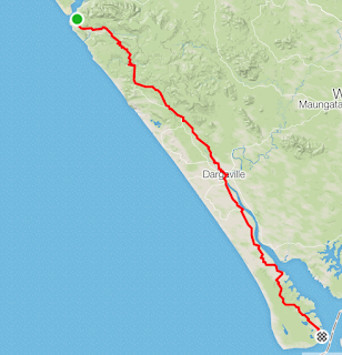
Strava Stats : 156.8 km 2182m height gain 8 hours 45 minutes cycling Long day to reach Pouto Point - to catch the ferry early the next morning. Intended to leave by 7:30am, but over-slept - so 8:30am start.  Straight up big hills to Tane Mahuta in in Waipoua Forest.  Caught up with an over-laden overweight Irishman called Alan, the first TA cyclist I seen since the start - and left him fairly quickly in the dust. The weather was dodgy - grey start, seemed to clear in the afternoon but big stormclouds would deliver heavy rain periodically. A stiff sidewind came up - nice and cooling and didn't slow me down.  A highlight was the temporary Donnelly's Crossing Cafe - set up for the TA - the owner told me that some earlier waves of riders had strong southerlies on 90 Mile Beach and took two or three days to ride it!  Dargaville was about 2/3 of the way - a long last 70km down the peninsula to Pouto Point had some nasty hills near the end - today's altitude gain wa...

Day 2: 9 March 2020

Image
Strava Stats : 126.7km 1618m height gain 7 hours 43 minutes Late start (10:10am) for Hukatere, but still too early for the tide - spent the first 90 minutes cycling in soft sand at 10km/h then the tide was low enough, got 30km/h - felt like flying with a good tailwind!  Sadly, weather was bad, with drizzle and periods of heavy rain. Kris met me at Ahipara at 12:30pm and after washing sand off the bike we had lunch at North Drift Cafe . It was here that I discovered that the ferry across Kaipara Harbour, which I'd intended to catch at 7pm on the 11th was not sailing at all after7am on the 11th, and they hadn't updated their website!  This fucked up my planning royally, and would mean two long days to reach Punto Point, or a 100km detour around the harbour  :(  SO..... after lunch decided to try and make it to Omapere, another 95km or so.  The trouble was, the roads were hilly - 1618m of altitude gain is more than Ben Nevis or the highest Tararua peak, alth...

Start of Tour Aotearoa

Image
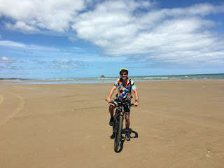
Today I started the Tour Aotearoa! There was a bit of a mad dash from the paragliding nationals competition in Rotorua, which finished yesterday. Driving from there to a friend's place near Tutukaka (a 5 hour drive) then another 4 hours this morning up to Cape Reinga for the official TA start at noon was a bit of a mission - luckily I have a very lovely and helpful partner (Kris) who I volunteered as my Uber driver. The day was pretty good for cycling - a brisk north east wind was (mostly) tailwind, and propelled me down Ninety Mile beach on firm sand at a brisk pace, to Hukatere Lodge Camp, where I had booked a cabin for me and Kris (my last night with Kris for a while as he heads south tomorrow).  As I started late today, I cycled a modest 75km in 4 hours of cycling (5 hours with rests). The real hard stuff starts tomorrow!  Here is my Strava track-log . PS - don't forget to check out my Give-a-Little page for the Pelorus bats: https://givealittle.co.nz...